The Secret Language of Maps
Maps are not just simple guides; they are powerful tools that reflect the values and biases of the people who draw them.

Before you read
2 key words from this story
Highlight a sentence, leave a note
Select any sentence in the story to share what you think. Your notes appear right on the text, so your classmates can read them, react, and reply — exactly where it matters.
What it looks like
The river carved its path through the valley as the town looked on.
3 notes · click any highlight to read them
More Than Just Lines
When you look at a map, you probably see a factual representation of the world. You see countries, borders, and oceans. However, every map is a choice. A mapmaker must decide what to include and what to leave out. They must also decide how to represent the size and shape of the earth on a flat piece of paper. This means no map is ever truly 'neutral.'
The Problem of Size
One of the most famous maps, the Mercator projection, makes countries near the poles look much larger than they actually are. For example, Greenland looks almost as big as Africa on many classroom maps. In reality, Africa is fourteen times larger than Greenland. This distortion has influenced how we perceive the importance of different regions for centuries.
This distortion has influenced how we perceive the importance of different regions for centuries.
Maps as Power
Historically, maps were used to claim land and show power. By putting a country in the center of the map, a nation could signal its importance to the world. For a long time, European maps placed Europe at the center, which made other parts of the world seem like they were on the 'edges' or 'periphery.' This was not an accident; it was a way of telling a story about who was in charge.
The Digital Shift
Today, we mostly use digital maps on our phones. These maps feel more objective because they are interactive. You can zoom in and out, and they update in real-time. Yet, even these maps have biases. They highlight certain businesses, prioritize specific routes, and often ignore smaller, less 'profitable' areas. The algorithm decides what you see.
Reading Between the Lines
Learning to read a map critically is a valuable skill. It reminds us that information is always framed by someone else's perspective. Whether it is a paper map from the 1800s or a GPS app on your smartphone, remember that you are looking at a version of the world, not the world itself. Always ask: who made this, and why did they choose to show it this way?
You're done
You just spent 3 minutes reading in English.
Enjoyed this story?
Tap the heart to let other readers know you enjoyed it.
My notes
Jot down personal reflections while you read — saved so you can review them later.
Check your understanding
4 questions with instant feedback
Let's talk about it
4 questions to spark conversation
Join the conversation
Your English doesn't have to be perfect — your ideas are what matter.
Respond to a question
Or share your reaction
No thoughts yet — be the first to start the discussion.
More from today

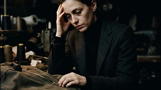
The Zipper: A Century of Failure
The zipper was invented in the 19th century but took decades to become a common part of our clothing.

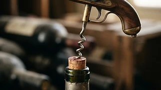
The Corkscrew: A Tool Born from Guns
The simple device used to open wine bottles has a surprising origin linked to 18th-century military technology.
🕳️ Want to go deeper?
Keep exploring
What is the Gall-Peters projection?
How do maps influence our sense of direction?
Take It With You
A few useful things you picked up
From “The Secret Language of Maps”.
Useful Expressions
distortion
C1 · noun
a change in the shape or size of something
“The mirror caused a distortion in my reflection.”
Useful for discussing data, images, and maps.
neutral
B2 · adjective
not supporting either side in an argument
“The judge must remain neutral.”
Essential for discussing politics and media.
Your English
You don’t need to memorise these now. You’ll meet useful language again as you keep reading.
See you tomorrow.
View your collection